Welcome to WASAVIES (WArning System for AVIation Exposure to Solar energetic particle) homepage. It calculates the radiation dose rates due to cosmic-ray exposure anywhere in the atmosphere based on the cosmic-ray observations at the ground level and geostationary orbit. The data are updated at intervals of 5 min and 1 day during solar storm and quiet periods, respectively.
Current condition
No radiation exposure event
*Currently, radiation dose rates are updated by 1 day interval.
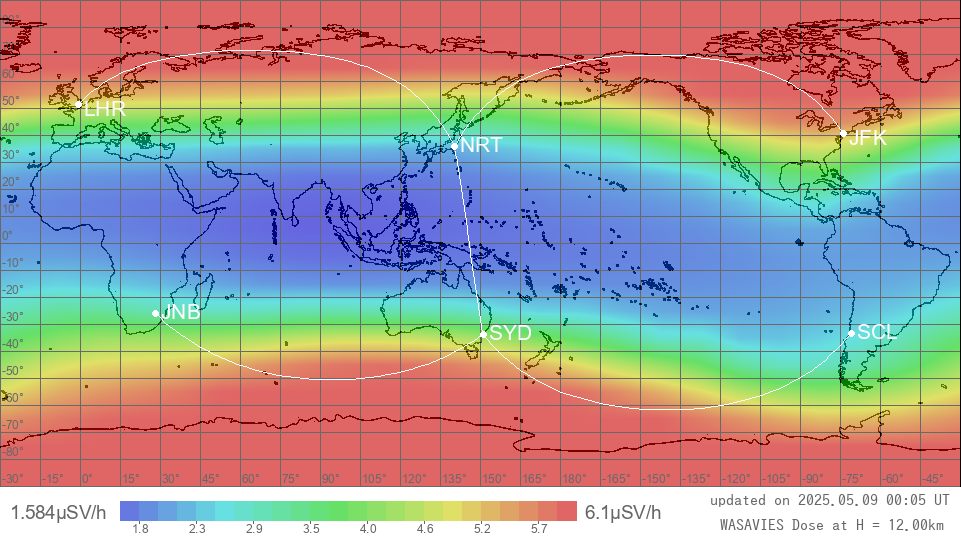
Current radiation dose rates at the altitude of 12 km (39,400 feet)
WASAVIES provides the following data
World dose rate map
World dose rate map at the altitudes between 0 and 100 km (328,000 feet)
ICAO threshold map
World dose rate map adopted to the format used in the ICAO advisory.
Route dose rate map
Dose rate map for selected 7 flight routes
Maximum dose rate
Time dependence of the highest dose rates in the world at certain altitudes at interval of 5 min
Count rates of neutron monitors
Time dependence of the count rates of neutron monitors used in WASAVIES at interval of 5 min
Proton flux measured by GOES
Time dependence of proton flux (E>100MeV) measured by geostationary satellite GOES at interval of 5 min